Item (Terrain with Labels)
Item Card (XML) | Package Info| ID | f429c8520ede449386423b9035b7804c |
| Owner | esri_en |
| Uploaded | Sep 15, 2020 |
| Modified | Oct 19, 2023 |
| Thumbnail |
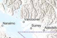
|
| GUID | N/A |
| Name | 0310_Terrain_Labels_Title |
| Title | Terrain with Labels |
| Type | Web Map |
| Type Keywords | ArcGIS Online, Explorer Web Map, Map, Online Map, sourceId#Terrain_with_Labels_Vector, Web Map |
| Description | This map features shaded relief imagery, bathymetry and coastal water features that provide neutral background with political boundaries and placenames for reference purposes. The map is intended to support the ArcGIS Online basemap gallery. For more details on the map, please visit the World Hillshade and Terrain with Labels. |
| Tags | basemap, vector |
| Snippet | This map features shaded relief imagery, bathymetry and coastal water features that provide neutral background with political boundaries and placenames for reference purposes. |
| Extent | [-180.0, -89.9962] - [180.0, 89.9962] |
| Spatial Reference | N/A |
| Access Information | N/A |
| License Information | This work is licensed under the Esri Master License Agreement. View Terms of Use |
| Culture | en-us |
| Properties | N/A |
| Advanced Settings | N/A |
| Url | N/A |
| Proxy Filter | N/A |
| Last Modified | N/A |
| Size | 985 |
| Documentation | N/A |
| App Categories | N/A |
| Industries | N/A |
| Languages | N/A |
| Listed | false |
| Comments Enabled | true |
| # Comments | 0 |
| # Ratings | 0 |
| Avg. Rating | 0.0 |
| # Views | 32780 |
| Categories | |
| Content Status |
Child Resources: Comments Rating Groups Item Data Item Data as Zip Item Dependencies
Supported Operations: Add Comment Add Rating Delete Rating Related Items Share Item Unshare Item Package Item Set Item Content Status